
Category 5 hurricanes, according to the National Weather Service, have wind speeds of 130 to 150 mph, which can lead to catastrophic damage. Well-constructed homes may lose most of their roofs or exterior walls, and fallen trees and power poles could isolate entire communities. Power outages might last for weeks, making areas uninhabitable for extended periods.
As the storm moves north, it is expected to create life-threatening surf and rip currents along beaches in the Bahamas, the U.S. East Coast, and Atlantic Canada. The National Hurricane Center issued an urgent warning for these areas on Saturday (August 16), urging people to stay cautious and aware of changing conditions.
AccuWeather’s lead hurricane expert, Alex DaSilva, mentioned that while the storm is forecast to remain hundreds of miles off the East Coast, coastal areas from Florida to New England, as well as Atlantic Canada, will likely experience rough surf and dangerous rip currents as Erin moves northward.
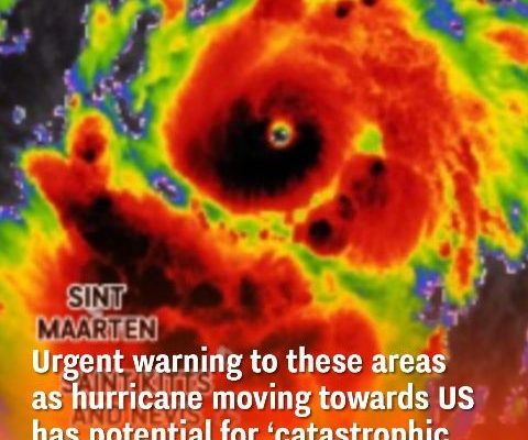
North Carolina’s Outer Banks, Long Island, and Cape Cod are at higher risk for more severe effects due to their protruding coastal geography. While Hurricane Erin weakened to a Category 3 storm by August 17, it is expected to return to Category 5 strength in the coming days.
This hurricane season is predicted to be above average. The National Oceanic and Atmospheric Administration (NOAA) forecasts 13 to 19 named storms for 2025, indicating a potentially active and destructive season ahead.